OLBA
Beirut International Airport

Archives
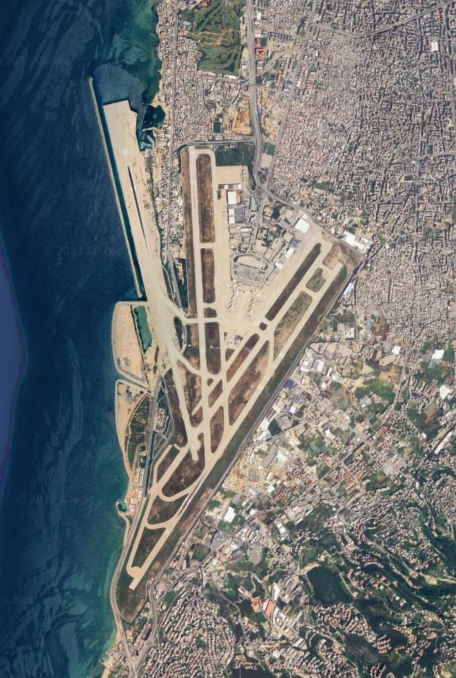
Beirut–Rafic Hariri International Airport (IATA: BEY) is the only operational commercial airport in Lebanon. It is located in the Southern Suburbs of Beirut, Lebanon, 9 kilometres (5.6 mi) from the city center. The airport is the hub for Lebanon’s national carrier, Middle East Airlines (MEA) and was the hub for the Lebanese cargo carrier TMA cargo and Wings of Lebanon before their respective collapses.
The airport was named after former Lebanese Prime Minister Rafic Hariri in 2005, following his assassination earlier that year.
It is the main port of entry into the country along with the Port of Beirut.
The airport opened on 23 April 1954, replacing the much smaller Bir Hassan Airfield which was located a short distance north. At the time of its opening, the terminal was very modern and it featured an excellent spotters terrace with a café. The airport consisted of two asphalt runways at the time. Runway 18/36 at 3,250 metres (10,663 ft) was used primarily for landings from the 18 end while runway 03/21 at 3,180 metres (10,433 ft) was used primarily for take-offs from both directions.
The airport grew to become a premier hub in the Middle East, thanks to limited competition from neighbours, with fast and steady growth by the country’s four carriers at the time, Middle East Airlines (MEA), Air Liban, Trans Mediterranean Airways (TMA), and Lebanese International Airways (LIA), and numerous other foreign carriers.
TIPS!
OLBA has the region’s most beautiful and thrilling STAR – LEBOR, passing at 13.000ft, only 3.000ft over the mighty Cedars snow covered forests in north Lebanon.
Want a challenge and a soaring view? Try LEBOR arrival for runway 21 in winter clear skies at dusk!
CLOSEST WEATHER STATIONS
INFORMATION
Coordinates: N33°49.14′ / E35°29.40′
Elevation: 85.0 feet MSL.
Variation: 5.3E
CHARTS
OLRA
Rayak Airbase

Archives
Tips!
Notable visits:
- On September 1, 1942, General de Gaulle.
- On September 26, 1949, Marquise de Freij and his wife.
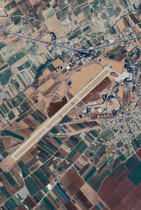
- On October 17, 1949, the British General Hayes, the supreme commander of the British troops in the Middle East, visited Rayak Air base and had lunch with its officers and the British squad there.
- On November 28, 1954, the US air force commander in West Tripoli General Glandburg.
Why wouldn’t you?
CLOSEST WEATHER STATIONS
INFORMATION
Coordinates: N33°51.10′ / E35°59.58′
Elevation: 2953.0 feet MSL.
Variation: 5.3E
CHARTS
OLKA
René Mouawad Airbase
ARCHIVES
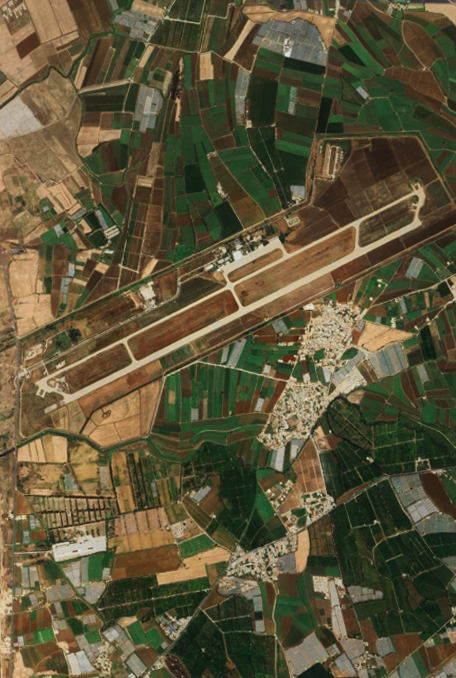
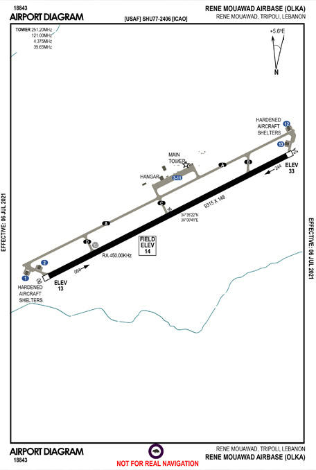
Rene Mouawad Airbase, formerly and still sometimes known as Kleiat airbase, used to be a military-civil joint airport in North Lebanon, 6 kilometres (3.7 mi) from the Lebanese–Syrian border.
In the early 1960s, the airbase was a small airport owned by an oil company, who used small IPC airplanes for transporting its engineers, staff and workers between Lebanon and the Arab countries.
In 1966, the Lebanese Army took control of the airport beginning the expansion and development of its technological capabilities. It later became one of the most modernized airbases in the region. According to an agreement signed by the Lebanese and French republic, a number of Mirage aircraft were supplied to the air force which saw pilots and technicians being sent to France to continue some courses related to the specified planes.
In the beginning of 1968, the military personnel finished their courses abroad and returned to Lebanon, with some pilots and technicians being transferred from Rayak Airbase to the Kleyate base. In April of the same year, two aircraft, flown by Lebanese pilots, arrived to Lebanon and other non-stop flights continued until June 1969.[1]
TIPS!
The Middle East Airlines formerly ran flights between this air base and Beirut to serve Tripoli and the surrounding area.[2]
Think you can Visually land your heavy aircraft there?
CLOSEST WEATHER STATIONS
INFORMATION
Coordinates: N34°35.17′ / E36°0.17′
Elevation: 23.0 feet MSL.
Variation: 5.3E
CHARTS
Z19O
Wujah El Hajar Airbase
ARCHIVES
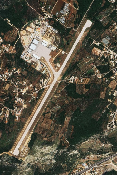
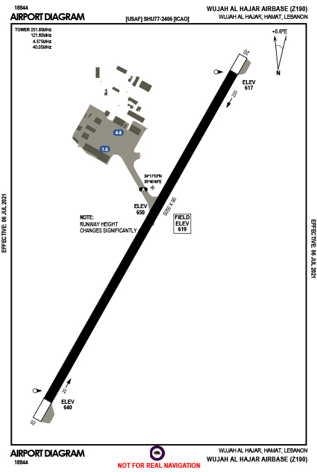
Hamat AirBase is a Lebanese Air Force base in Hamat, Lebanon. It was built in the mid-1970s.
The airport was however never used for civilian purposes.
Although its heavily damaged runway (numerous holes as result of airstrikes) has been patched, the airfield is currently used only by the Lebanese Air Force with MD-530F Defenders helicopters and Super Tucano light attack aircraft.
The airfield is also used by the Special Forces school.
TIPS!
CLOSEST WEATHER STATIONS
INFORMATION
MILITARY AIRPORT
Coordinates: N34°17.00′ / E35°40.80′
Elevation: 650.0 feet MSL.
Variation: 5.4E
CHARTS
BAADARAN
Airfield

Archives
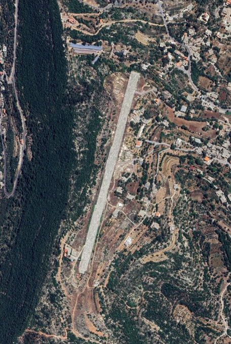
The Baadaran runway takes its name from the Chouf village where it is located, not far from Mukhtara. Located at the top of the Chouf mountains, it owes its existence to the Progressive Socialist Party. In the early years of the 1975-90 Civil War, the short 850-meter runway was intended to enable the Druze to have their own airport, in addition to the port of Khaldeh.
Although enlarged in 2007, the runway is no longer used for civilian or military flights, but rather for tourists, concerts and model aircraft enthusiasts.
TIPS!
You like doing stunts and crazy things? This airport is uncontrolled!
A kingdom of your own!
CLOSEST WEATHER STATIONS
INFORMATION
Coordinates: N33°38.15′ / E35°36.81′
Elevation: 3,495 feet MSL.
Variation: 5.3E

